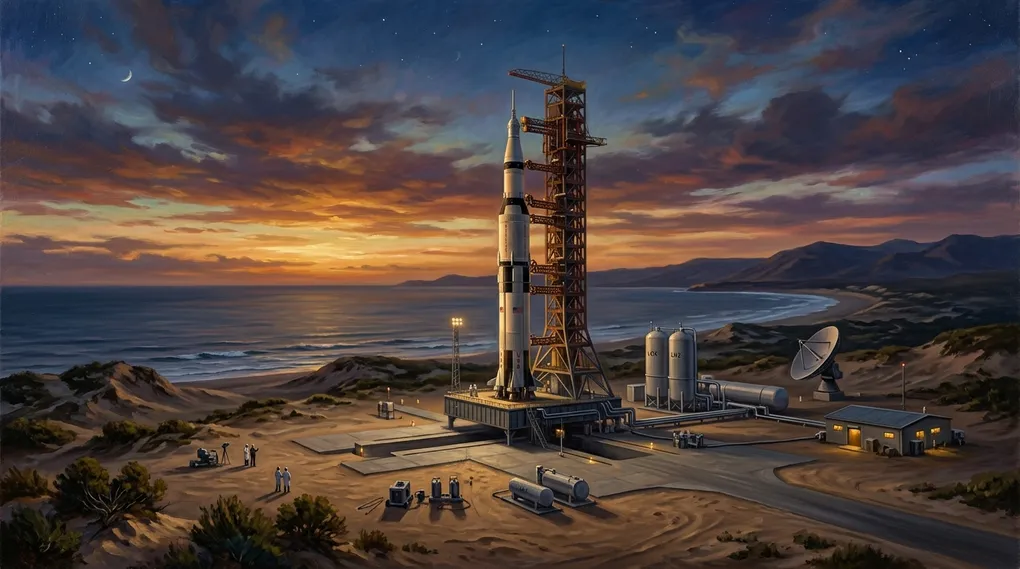
Spaceports in the Americas: Orbital Physics, Geopolitics, and the Race for the Equatorial Belt
Table of contents9›
When observing the map of the Western Hemisphere through the lens of astrodynamics, a striking paradox emerges: while the northern half of the continent commands the capital, the aerospace conglomerates, and the most monumental industrial launch infrastructure in human history, the southern half holds stewardship over the rarest and most unyielding asset of celestial mechanics: the South American equatorial belt (admired for concentrating the highest tangential rotational velocity on Earth and enabling direct insertion into geostationary orbits without energy-depleting plane-change penalties).
For decades, the popular space narrative compressed the Americas into a single geographical axis: the coastal marshes of Florida and the arid bluffs of California. Yet in the twenty-first century, an unprecedented geostrategic reorganization is underway. Spaceports are no longer merely closed military proving grounds or pharaonic monuments of the Cold War; they have evolved into multimodal commercial logistics gateways. From the colossal launch towers of Texas and Florida to emerging ventures across the Caribbean, the hyper-arid coastline of Peru, the zero latitude of Ecuador, and polar trajectory platforms in Argentina, continental geography is being reordered to claim the immutable laws of universal gravitation.
The Pioneer Root: Pedro Paulet and the Genesis of the Liquid-Propellant Rocket Engine
Any historical examination of the American continent’s role in astronautical conquest demands tribute to its preeminent continental forerunner: the Peruvian diplomat, chemist, and polymath from Arequipa, Pedro Eleodoro Paulet Mostajo (1874–1945) (admired for pioneering the liquid-propellant rocket motor and designing the visionary aerospace torpedo aircraft at the close of the nineteenth century, decades ahead of the formal demonstrations of Robert Goddard and Hermann Oberth).
Born on July 2, 1874, in the traditional district of Tiabaya in the Arequipa valley, Paulet exhibited from childhood a passionate fascination with pyrotechnic chemistry and mechanical physics. After studying letters and sciences at the National University of Saint Augustine, the Peruvian government awarded him an official state scholarship to train in Paris. He enrolled in the prestigious Institute of Applied Chemistry at the University of Paris (Sorbonne), where he became a distinguished pupil of the renowned chemist and professor Marcellin Berthelot.
 Pedro Paulet Mostajo circa 1910, Peruvian and universal pioneer of liquid-propellant rocketry (Credit: Historical Archive / Public domain).
Between 1895 and 1897, in the laboratories of the Sorbonne, Paulet materialized and experimentally fired his celebrated two-and-a-half-kilogram «rocket motor»: a conical combustion chamber forged from vanadium steel, continuously fed by two hypergolic propellants (nitrogen tetroxide as oxidizer and petroleum naphtha or gasoline as fuel). The device achieved an operating rate of three hundred detonations per minute, sustaining a constant net thrust of ninety kilograms-force for continuous firing periods of up to fifteen minutes. Decades later, in his authoritative volume History of Rocketry and Space Travel, the director of NASA’s Marshall Space Flight Center, Wernher von Braun, affirmed the historical precedence of the Andean pioneer:
«Pedro Paulet was in Paris in those years experimenting with his tiny two-and-a-half-kilogram engine, and he achieved a thrust of ninety kilograms. By virtue of this achievement, Paulet must be considered the true pioneer of the liquid-propellant rocket motor».
Paulet’s legacy took institutional root in Peru in 1974 with the establishment of the National Commission for Aerospace Research and Development (CONIDA) and the construction of the Punta Lobos Scientific Base in Pucusana (south of Lima, $12^\circ 30’,\text{S}$). Throughout the 1970s and 1980s, in technical partnership with NASA and the German aerospace agency DLR, dozens of suborbital sounding rockets (Nike-Apache, Black Brant, Super Arcas, and the domestic Paulet series) were launched from Punta Lobos to investigate the Equatorial Electrojet and plasma irregularities across the tropical ionosphere.
The Physics of Location: Earth Rotation, Latitude, and Plane-Change Penalties
The selection of a spaceport site represents a rigorous compromise between celestial mechanics and territorial safety. First, the linear tangential velocity ($v_{\text{rot}}$) imparted by Earth’s rotation to any object on its surface is a direct function of geographic latitude ($\phi$):
$$v_{\text{rot}}(\phi) = \omega_{\oplus} , R_{\oplus} , \cos(\phi)$$
Where $\omega_{\oplus} \approx 7.2921 \times 10^{-5},\text{rad/s}$ represents the planet’s rotational angular velocity and $R_{\oplus} \approx 6,378,\text{km}$ denotes equatorial radius. At the geographic equator ($\phi = 0^\circ$), this tangential velocity reaches its absolute maximum:
$$v_{\text{rot}}(0^\circ) \approx 465.1,\text{m/s} \quad (\approx 1,674,\text{km/h})$$
This initial velocity acts as a «free» kinetic assist gifted by Earth’s eastward (prograde) rotation. As latitude increases toward the poles, this assist degrades steadily according to the geographic cosine:
- Geographic Equator ($\phi = 0^\circ$): $\approx 465.1,\text{m/s}$
- Guiana Space Centre in Kourou ($\phi \approx 5.2^\circ,\text{N}$): $\approx 463.2,\text{m/s}$
- Cape Canaveral, Florida ($\phi \approx 28.5^\circ,\text{N}$): $\approx 409.0,\text{m/s}$ (penalty of $\approx 56,\text{m/s}$)
- Wallops Island, Virginia ($\phi \approx 37.8^\circ,\text{N}$): $\approx 367.5,\text{m/s}$ (penalty of $\approx 98,\text{m/s}$)
- Kodiak Island, Alaska ($\phi \approx 57.4^\circ,\text{N}$): $\approx 250.5,\text{m/s}$ (penalty of $\approx 215,\text{m/s}$)
The second physical constraint stems from the law of minimum orbital inclination: an orbital launch vehicle ascending directly into space without performing out-of-plane steering maneuvers naturally enters an orbit whose inclination ($i$) relative to the equatorial plane is equal to or greater than the latitude of its launch site ($i \ge \phi$). Consequently, to place a satellite into geostationary orbit (GEO, where $i = 0^\circ$), a rocket launched from mid-latitudes must ignite its upper stage engines in space to execute a dogleg plane change:
$$\Delta v_{\text{plane}} = 2 , v_{\text{orb}} , \sin\left(\frac{\Delta i}{2}\right)$$
If executed in low Earth orbit (LEO, where $v_{\text{orb}} \approx 7.8,\text{km/s}$), an angular inclination penalty of $\Delta i = 28.5^\circ$ (typical of Florida) demands a $\Delta v$ in excess of $3.8,\text{km/s}$, severely eroding payload capacity or necessitating extra upper-stage propellant. While operational missions perform this plane change at the apogee of a geostationary transfer orbit (GTO, where orbital velocity drops to $\approx 1.6,\text{km/s}$), the required velocity increment still hovers near $1,500,\text{m/s}$. In contrast, from an equatorial site ($\phi = 0^\circ$), the propellant cost for zero-inclination insertion is virtually zero.
The launch heading or azimuth ($\beta$) similarly dictates the resulting orbital inclination:
$$\cos(i) = \cos(\phi) , \sin(\beta)$$
For equatorial or low-inclination orbits, the launch corridor must orient eastward ($\beta \approx 90^\circ$). For polar or Sun-synchronous orbits (SSO, $i \approx 97^\circ - 98^\circ$), trajectories must fire northward or southward over unpopulated oceanic expanses.
North America’s Consolidated Bastions: From Cape Canaveral to Polar Pacific Waters
In the Northern Hemisphere, the United States has engineered the globe’s most versatile, redundant, and technologically sophisticated launch infrastructure network, bridging historic federal complexes with private commercial hubs:
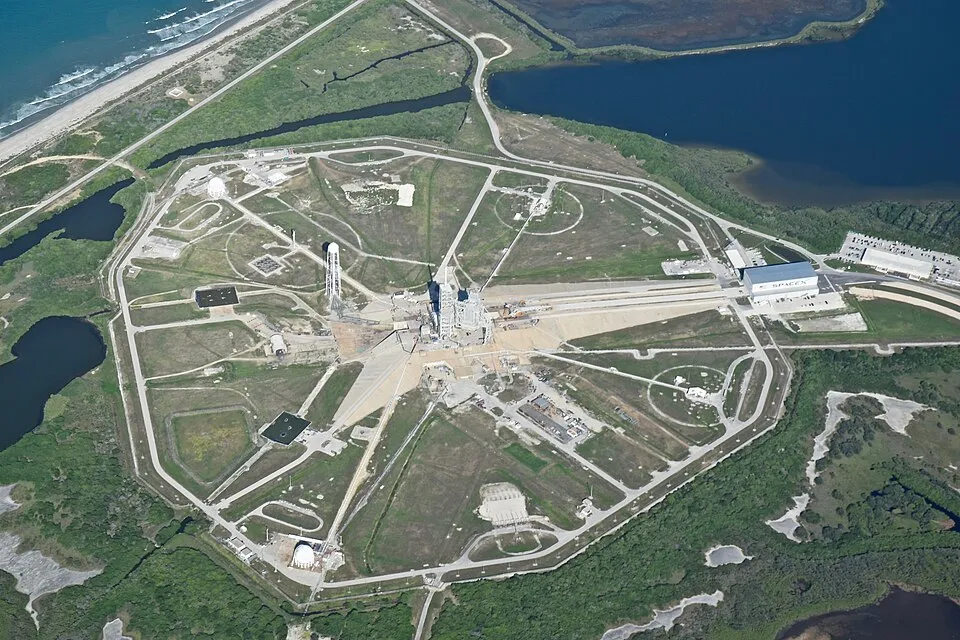 The historic Launch Complex 39A (LC-39A) at Kennedy Space Center, Florida, adapted for SpaceX crewed and commercial missions (Credit: NASA / Public domain).
-
Cape Canaveral and Kennedy Space Center (Florida, $28.5^\circ,\text{N}$): The historic heartland of Western astronautics. Comprising Cape Canaveral Space Force Station (CCSFS) and NASA’s John F. Kennedy Space Center (KSC), it leverages the vast oceanic corridor of the Eastern Range across the open Atlantic. It hosts iconic pads including LC-39A (operated by SpaceX for Falcon 9 and Falcon Heavy), LC-39B (reserved by NASA for the Space Launch System on Artemis lunar flights), and SLC-40 and SLC-41 for commercial and national security payloads.
-
Vandenberg Space Force Base (California, $34.7^\circ,\text{N}$): Perched on the rugged Pacific bluffs of Santa Barbara County, Vandenberg serves as America’s premier gateway to polar and Sun-synchronous orbits (Western Range). By firing directly southward across uninhabited ocean waters, complexes such as SLC-4E deploy Earth observation constellations, planetary surveillance missions, and major rideshare packages without overland overflight hazards.
-
Starbase (Boca Chica, Texas, $25.9^\circ,\text{N}$): Situated at the southernmost tip of Texas near the Rio Grande outlet into the Gulf of Mexico, Starbase constitutes the highest concentration of reusable rocket manufacturing and testing on Earth. SpaceX chose this location for offering the lowest latitude in the contiguous United States and an eastern maritime firing corridor through the Florida Straits and Caribbean Sea, anchoring flight tests for the Starship and Super Heavy architecture.
-
Spaceport America (New Mexico, $32.9^\circ,\text{N}$): Constructed in the arid Jornada del Muerto basin, Spaceport America is the world’s first purpose-built commercial spaceport. Designed by architect Norman Foster, its three-kilometer runway is engineered for horizontal takeoff and landing vehicles, supporting Virgin Galactic’s commercial suborbital human spaceflight operations.
-
Pacific Spaceport Complex – Alaska (Kodiak Island, $57.4^\circ,\text{N}$): Located on Kodiak Island, Alaska, this subarctic polar launch complex is operated by the state-owned Alaska Aerospace Corporation. Its high latitude allows direct insertion into high-inclination orbits ($63^\circ - 110^\circ$) free from crowded air corridors, supporting Department of Defense missions and responsive commercial micro-launchers such as Astra.
The European Enclave in the South American Tropics: Kourou
On South America’s northeastern coastline lies the world’s most energetic and efficient orbital spaceport for equatorial and geostationary missions: the Guiana Space Centre (Centre Spatial Guyanais, CSG), located in Kourou, French Guiana ($5^\circ 14’,\text{N}$).
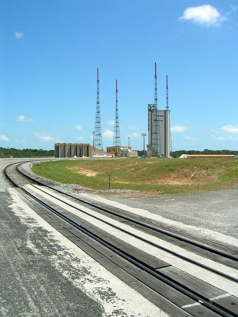 Launch pad facilities at the Guiana Space Centre (CSG) in Kourou, Europe’s equatorial commercial spaceport in South America (Credit: ESA / Public domain).
Jointly managed by France’s National Centre for Space Studies (CNES) and the European Space Agency (ESA), Kourou combines three extraordinary geographical advantages:
- Immediate Equatorial Proximity: Located barely $500,\text{km}$ north of the equator, it captures $99.6%$ of Earth’s theoretical surface rotational velocity ($463.2,\text{m/s}$).
- Dual Maritime Trajectory Corridors: It features an unobstructed eastward launch azimuth over the Atlantic Ocean (for geostationary deployments aboard Ariane 6) alongside a clear northward launch azimuth over open waters (for polar and Sun-synchronous missions aboard Vega-C), eliminating population overflight risks.
- Tectonic and Meteorological Stability: French Guiana rests on the ancient crystalline Guiana Shield, completely immune to destructive Andean seismic activity and sheltered south of the typical Caribbean tropical hurricane tracks.
The Awakening of the South American Equatorial Belt
Beyond Europe’s enclave in Kourou, Latin American nations have launched a deliberate revitalization of sovereign and commercial spaceport infrastructures, positioning their geography as engines of frontier technological progress:
1. Ecuador: From the Chimborazo Vector and Project Latitude to the Potential of El Aromo
Ecuador possesses a privileged astronautical and geodetic condition on Earth: the equatorial line traverses its continental mainland and the Galápagos archipelago from east to west, conferring zero latitude ($\phi = 0^\circ$) and the planet’s maximum surface rotational tangential velocity ($465.1,\text{m/s}$). Beyond this natural kinetic boost, a decisive physical anomaly comes into play: because of Earth’s rotational equatorial bulge driven by centrifugal force, the planet’s radius is approximately twenty-one kilometers wider at the equator than at the poles. As a consequence of this oblate spheroidal geometry, the summit of Mount Chimborazo ($6,263.47,\text{m}$ above sea level, yet positioned $6,384.4,\text{km}$ from Earth’s geocenter) represents the point on Earth’s crust farthest from the planetary core, exceeding Mount Everest by more than two kilometers in absolute radial distance toward outer space.
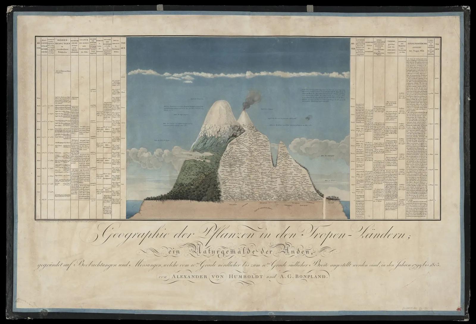 Mount Chimborazo depicted in Alexander von Humboldt’s classical Naturgemälde (1807), representing Ecuador’s equatorial geodetic prominence as the point on Earth farthest from the planet’s center (Credit: Historical Archive / Public domain).
This orographic and geodetic advantage not only inspired the foundational measurements of the French Geodesic Mission in the eighteenth century alongside the Riobambeño polymath Pedro Vicente Maldonado, but also offers tangible astrodynamic merits. At elevated equatorial altitudes, atmospheric density ($\rho$) drops sharply, dramatically mitigating initial aerodynamic drag and attenuating the maximum dynamic pressure ($q_{\text{max}}$) endured by ascending launch structures. Furthermore, this physical distinction supported the historic Bogotá Declaration of December 1976, through which equatorial nations asserted before the international community the strategic significance of the geostationary orbit (GEO) segments directly above their sovereign territories.
Regarding aerospace support ground infrastructure, Ecuador maintains a distinguished historical precedent: the Cotopaxi Tracking Station (established by NASA in 1957 in Pastocalle as part of the Minitrack / STADAN network). Thanks to its strategic position along the 75th meridian west, this Andean ground facility played a critical tracking role across Project Vanguard, Mercury, Gemini, Apollo, and early Space Shuttle Columbia missions before its permanent transfer to Ecuadorian state management in 1982.
Today, the ambition to anchor a sovereign spaceport is advancing through Project Latitude, a strategic commercial partnership established between US aerospace firm Blackstar Orbital and Ecuadorian company Leviathan Space Industries. The venture envisions a dual-capability launch installation targeted for 2030: vertical launch pads for light orbital rockets paired with heavy-duty runways engineered for horizontal takeoffs and landings of reusable spaceplanes and autonomous orbital logistics drones. Coastal sites such as the Santa Elena Peninsula and Salinas Air Base provide fully unobstructed launch corridors across the open Pacific Ocean, enabling polar and equatorial ascents without overland overflight hazards. Reinforced by Ecuador’s formal accession to NASA’s Artemis Accords in June 2023, the initiative is coordinating with the Directorate General of Civil Aviation (DGAC) and the Ecuadorian Air Force (FAE) to codify the national regulatory architecture for commercial suborbital and orbital operations.
Alongside the alternatives in Santa Elena, aerospace feasibility analyses have increasingly turned toward a singular domestic site: the El Aromo plateau (located in the rural corridor between the cantons of Manta and Montecristi, Manabí province, at $1^\circ 03’,\text{S}$ and $80^\circ 46’,\text{W}$, rising $200\text{ to }280,\text{m}$ above sea level). Originally cleared and engineered to host the petrochemical complex of the Pacific Refinery, this state-owned parcel underwent massive earthmoving operations that left an engineered, flattened, and compacted plateau exceeding 1,200 hectares (with over 600 hectares in its primary industrial core). This pre-existing geotechnical grading represents hundreds of millions of dollars in civil engineering savings, providing an expansive footprint capable of accommodating both vertical launch pads with wide safety clearance buffers (blast zones) and a 4-to-4.5-kilometer horizontal runway for reusable spaceplanes and heavy aerospace logistics.
From an astrodynamic and ground-support engineering standpoint, El Aromo exhibits exceptional credentials. Positioned barely one degree south of the equator ($\phi = 1.06^\circ,\text{S}$), it provides a surface rotational tangential velocity of $v_{\text{rot}} \approx 465.0,\text{m/s}$ —capturing $99.98%$ of Earth’s theoretical rotational maximum—, outpacing Kourou ($463.2,\text{m/s}$), Alcântara ($464.7,\text{m/s}$), and the Santa Elena Peninsula ($464.8,\text{m/s}$). Critically, the site features the La Esperanza – El Aromo Aqueduct (a 96-kilometer high-flow water transmission pipeline built for the refinery), an invaluable hydraulic asset that solves the massive water supply challenge required by sound suppression deluge systems (Water Deluge Systems), essential for absorbing the violent barometric shock waves ($> 210,\text{dB}$) of rocket liftoffs without depleting local municipal aquifers. Furthermore, the location benefits from a robust multimodal logistics nexus within a 25-kilometer radius: the Deepwater Port of Manta (permitting maritime roll-on/roll-off deliveries of wide-body rocket stages and cryogenic propellant tanks that cannot navigate Andean mountain passes) and the Eloy Alfaro International Airport (whose 2.8-kilometer runway accommodates intercontinental strategic freighters transporting encapsulated satellites).
The primary engineering challenge facing El Aromo centers on downrange azimuth corridors and range safety management, dictated by its western Pacific coastal orientation:
- Unobstructed Polar & Sun-Synchronous Corridor Across the South Pacific: Situated just 6 kilometers from Manabí’s marine cliffs (Cape San Lorenzo and Pacoche), launches directed south-southwest ($\beta \approx 188^\circ\text{–}195^\circ$) reach open Pacific waters in seconds, benefiting from an uninterrupted ocean corridor spanning over 8,000 kilometers toward Antarctica without overland overflight, positioning El Aromo as a world-class candidate for polar and Sun-synchronous Earth observation constellations (SSO, $i \approx 98^\circ$).
- Horizontal Launch & Air-Launch Architectures: A carrier aircraft or reusable spaceplane can take off from El Aromo’s runway, cruise 150 kilometers offshore over international waters, and release its rocket stage at high altitude toward any orbital azimuth with zero populated area hazard.
- The Eastward Prograde Dilemma (GEO Injections): For direct eastward equatorial injections ($\beta = 90^\circ$ toward GEO), an expendable rocket would shed its spent booster stages across the Andean mountain range or the Amazon basin, an unacceptable range-safety hazard. Consequently, harvesting El Aromo’s eastward equatorial boost is intrinsically bound to next-generation reusable launch systems featuring Return-to-Launch-Site (RTLS) architectures, wherein the first-stage booster propulsively returns to land on coastal pads at El Aromo or offshore drone ships in the Pacific, while the second stage crosses the continental landmass at exoatmospheric altitudes ($> 120,\text{km}$).
| Factor / Project | Location / Coordinates | Key Technical Parameter | Astrodynamic & Operational Advantage | Status & Stakeholders |
|---|---|---|---|---|
| Zero Latitude (Equinoctial Line) | Continental mainland & Galápagos ($0^\circ 00’$) | $v_{\text{rot}} = 465.1,\text{m/s}$ | Maximum rotational kinetic boost; direct GEO injection without plane-change penalty ($\Delta i = 0^\circ$) | Permanent natural geographic condition |
| Chimborazo Geodetic Vector | Western Cordillera ($1^\circ 28’,\text{S}$) | Geocentric radius $R = 6,384.4,\text{km}$ | Earth’s closest surface point to outer space; reduction in atmospheric density ($\rho$) and dynamic pressure ($q_{\text{max}}$) | Orographic and geodetic singularity |
| El Aromo (Manabí / Manta) | Central Manabí coast ($1^\circ 03’,\text{S}$) | $v_{\text{rot}} = 465.0,\text{m/s}$ (1,200 ha leveled) | $99.98%$ rotational boost; 96 km aqueduct for deluge; deepwater port & airport $<25$ km | Pre-existing industrial site evaluated for dual-use aerospace logistics |
| Project Latitude (Spaceport) | Santa Elena / Salinas Air Base ($2^\circ 12’,\text{S}$) | Dual architecture: Horizontal runway & vertical pad | Unobstructed corridors across the western & southern Pacific; zero overland overflight hazards | Under development targeted for 2030 (Leviathan Space / Blackstar Orbital) |
| Cotopaxi Tracking Station | Pastocalle, Cotopaxi ($0^\circ 40’,\text{S}$) | STADAN / Minitrack network ($75^\circ,\text{W}$) | Downrange telemetry and orbital tracking for pioneer flights (Mercury, Gemini, Apollo, STS-2) | Historical (NASA 1957–1981; transferred to Ecuador in 1982) |
| Regulatory Framework & Artemis Accords | State Level (Foreign Ministry / DGAC / FAE) | 26th signatory nation of Artemis Accords (2023) | Commercial suborbital flight licensing & international scientific space cooperation framework | Active & institutionalized |
2. Peru: The Talara Spaceport Initiative
In December 2023, the Peruvian government formally integrated the National Spaceport of Talara into its Multi-Year Public-Private Partnership Investment Portfolio, situated at El Pato Air Base (Talara Province, Piura Region, $4^\circ 34’,\text{S}$).
Formulated under a technical cooperation framework involving the Peruvian Air Force (FAP), CONIDA, and United States Space Command (USSPACECOM), the facility capitalizes on exceptional conditions: an arid coastal climate with more than three hundred clear days annually, unobstructed oceanic corridors across the Pacific for polar trajectories, and equatorial proximity that dramatically reduces orbital insertion propellant requirements.
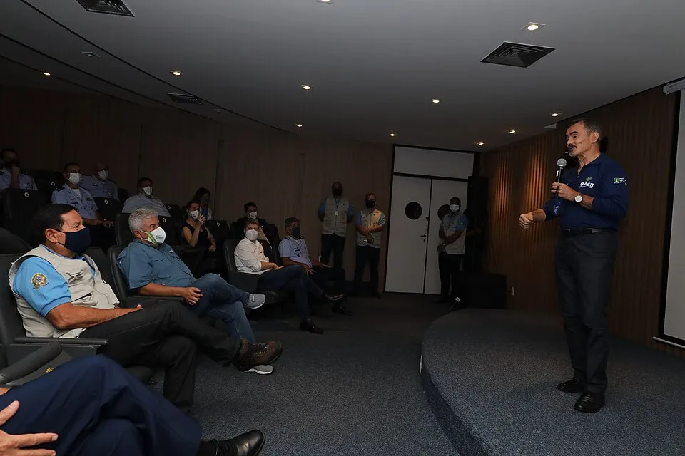 Launch pad facilities at the Alcântara Launch Center (CLA), Maranhão, Brazil (Credit: FAB Archive / Public domain).
3. Brazil: The Redemption of Alcântara
The Alcântara Launch Center (Centro de Lançamento de Alcântara, CLA) in Maranhão ($2^\circ 23’,\text{S}$) represents South America’s most capable domestic aerospace asset. Situated just two degrees south of the equator, it provides launch vehicles with a $20%$ to $30%$ fuel-efficiency advantage over Cape Canaveral or Baikonur for geostationary transfer flights.
After surmounting the tragic August 2003 pad explosion of the VLS-1 V03 rocket, which claimed the lives of twenty-one engineers and specialists of the Institute of Aeronautics and Space (IAE), Brazil modernized the site through the bilateral Technology Safeguards Agreement (TSA) signed with the United States in 2019. This framework enabled international private space companies to operate from Alcântara while safeguarding proprietary intellectual property, demonstrated in March 2023 by the successful flight of the suborbital HANBIT-TLV rocket by South Korean launch company Innospace.
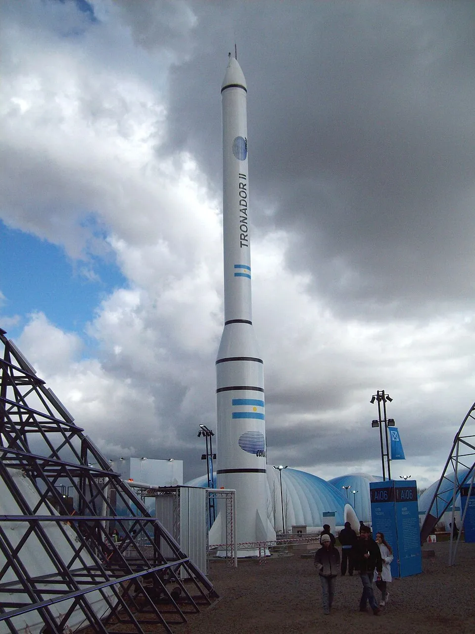 Structure of the Argentine Tronador II launch vehicle undergoing tests at the Punta Indio Space Centre (Credit: CONAE Archive / Public domain).
4. Argentina: The Sovereign Polar Vector of Tronador II
In the Southern Cone, Argentina’s National Commission on Space Activities (CONAE) has pursued an architecture specialized in polar and Sun-synchronous trajectories for Earth observation spacecraft (such as the SAOCOM radar constellation).
Operating through the Punta Indio Space Centre and the Manuel Belgrano Space Centre in Puerto Belgrano (near Bahía Blanca, Buenos Aires Province, $38^\circ 58’,\text{S}$), Argentina is developing the sovereign Tronador II launch vehicle. By directing southern liftoff azimuths across the Argentine Sea toward the Antarctic continent, the complex ensures a completely unpopulated trajectory free from commercial shipping and aviation corridors.
Emerging Frontiers in Mesoamerica and the Caribbean
The expansion of NewSpace commercial logistics has energized new geographical initiatives across the wider Caribbean basin:
- Dominican Republic (Pedernales Spaceport, $17^\circ 50’,\text{N}$): Located along the southwestern coast, Pedernales is undergoing feasibility studies as a strategic site for commercial micro-launchers firing eastward and southeastward across the Caribbean Sea and open Atlantic.
- Mexico (Querétaro Intercontinental Airport - AIQ, $20^\circ 37’,\text{N}$): The Mexican Space Agency (AEM) is pursuing certification for horizontal spaceplane takeoffs and atmospheric re-entry at AIQ, leveraging the Bajío region’s advanced aerospace manufacturing cluster for next-generation orbital value chains.
Technical Synthesis of Spaceports Across the Americas
| Spaceport | Country | Latitude ($\phi$) | $v_{\text{rot}}$ ($\text{m/s}$) | Primary Target Orbits | Operational Status & Operators |
|---|---|---|---|---|---|
| Kourou (CSG) | France / Fr. Guiana | $5^\circ 14’,\text{N}$ | $463.2$ | GEO, LEO, Polar, SSO | Active (ESA / CNES / Arianespace) |
| Alcântara (CLA) | Brazil | $2^\circ 23’,\text{S}$ | $464.7$ | GEO, LEO, MEO | Active (FAB / AEB / Commercial) |
| Talara (El Pato) | Peru | $4^\circ 34’,\text{S}$ | $463.6$ | Polar, SSO, LEO | Under Development (FAP / CONIDA / USSPACECOM) |
| El Aromo (Manta / Montecristi) | Ecuador | $1^\circ 03’,\text{S}$ | $465.0$ | Polar, SSO, Dual Horizontal, RTLS | Pre-graded site (1,200 ha) & aqueduct; dual-use potential |
| Project Latitude | Ecuador | $2^\circ 12’,\text{S}$ | $464.8$ | Horizontal LEO, Suborbital | Feasibility Study (Leviathan / Blackstar Orbital) |
| Cape Canaveral / KSC | United States | $28^\circ 30’,\text{N}$ | $409.0$ | LEO, GEO, Lunar/Interplanetary | Active (NASA / USSF / SpaceX / ULA) |
| Vandenberg (VSFB) | United States | $34^\circ 44’,\text{N}$ | $382.2$ | Polar, SSO, Retrograde | Active (USSF / SpaceX / Firefly) |
| Starbase | United States | $25^\circ 59’,\text{N}$ | $418.1$ | LEO, Lunar, Interplanetary | Active (SpaceX) |
| Spaceport America | United States | $32^\circ 59’,\text{N}$ | $390.2$ | Horizontal Suborbital | Active (Commercial / Virgin Galactic) |
| Pacific Spaceport (Kodiak) | United States | $57^\circ 26’,\text{N}$ | $250.5$ | Polar, Extreme SSO | Active (Alaska Aerospace / DoD / Astra) |
| Manuel Belgrano / Punta Indio | Argentina | $38^\circ 58’,\text{S}$ | $361.6$ | Polar, SSO | Under Development (CONAE / VENG) |
Conclusion and Geostrategic Horizons
The geography of the American continent demonstrates that humanity’s reach into the cosmos is not governed solely by capital expenditure or raw cryogenic engine thrust; it remains irrevocably tied to the geometry of the Earth. While North America has mastered high-tempo industrial launch throughput and commercial mega-installations, the South American equatorial belt commands celestial mechanics’ most coveted energetic dividend.
As launch costs per kilogram continue their historic downward trajectory and global demand for satellite mega-constellations accelerates, Western Hemisphere launch facilities are converging into a complementary space architecture: coastal polar platforms at northern and southern extremes dedicated to global Earth observation, and equatorial launchpads dedicated to deep commercial logistics and interplanetary exploration toward the Moon and Mars.
Verified Documentary Sources
- National Aeronautics and Space Administration (NASA) — Kennedy Space Center: History, Facilities and Launch Complexes: https://www.nasa.gov/kennedy/
- European Space Agency (ESA) — Europe’s Spaceport in French Guiana: History, Geographic Advantages and Operations: https://www.esa.int/Enabling_Support/Space_Transportation/Europe_s_Spaceport
- National Commission for Aerospace Research and Development of Peru (CONIDA) — History of Punta Lobos Scientific Base and the Talara Spaceport Project: https://www.gob.pe/conida
- National Commission on Space Activities of Argentina (CONAE) — Space Access Programme and Tronador II Launch Vehicle: https://www.argentina.gob.ar/ciencia/conae
- Smithsonian National Air and Space Museum — Pedro Paulet: Pioneer of Liquid-Propellant Rocketry: https://airandspace.si.edu/
- Spaceport America — New Mexico Spaceport Authority Official Portal and Commercial Flight Operations: https://spaceportamerica.com/
- International Telecommunication Union (ITU) — Geostationary Satellite Orbit and Radio Regulations Framework: https://www.itu.int/
- United Nations Office for Outer Space Affairs (UNOOSA) — Treaty on Principles Governing the Activities of States in the Exploration and Use of Outer Space: https://www.unoosa.org/
- Peruvian Air Force (FAP) — Strategic Aerospace Surveillance and Technological Development Projects: https://fap.mil.pe/
- SpaceX — Starbase Facility Overview and Mars Launch Operations: https://spacex.com/